This launch marks a significant evolution in laser scanning technology, focusing on real-time data sharing and workflow connectivity. The economic and operational benefits are clear for industries requiring high precision and efficient data handling.
Problem
In the fast-paced world of surveying, construction, and industrial plant management, professionals have long grappled with the challenge of real-time data accessibility and seamless workflow integration. Traditional laser scanning solutions, while capable, often fell short in providing the connectivity needed for efficient collaboration between field and office teams. The Leica RTC360/LT and ScanStation P-Series, while reliable, lacked the integrated features necessary for modern, data-driven projects.
Solution
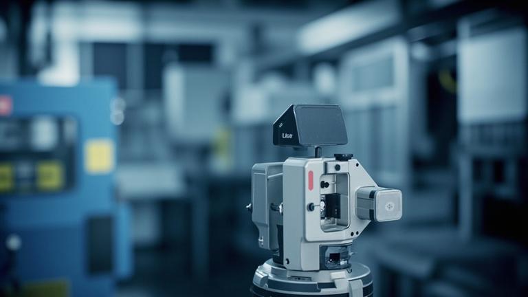
Leica Geosystems, a division of Hexagon, has addressed these challenges with the introduction of the Leica RTC series, comprising the RTC300, RTC500, and RTC700 models. This new lineup is engineered to enhance scanning speed, accuracy, and range while introducing a paradigm shift in workflow connectivity.
### Key Features and Technical Details
- Scalable Performance: The RTC series is built on a unified platform, offering three performance tiers. This allows users to upgrade as project demands evolve without the need to replace the entire system. The RTC300, RTC500, and RTC700 cater to varying levels of complexity and precision, ensuring flexibility for diverse applications.
- Connected Workflows: A standout feature of the RTC series is its ability to support real-time data sharing. The integration of Leica Cyclone FIELD 360 with Livelink enables live streaming of scan data to Hexagon GeoCloud during the scanning process. This capability allows multiple scanners to contribute to a shared project simultaneously, providing teams with immediate access to critical data.
- Enhanced Collaboration: With the RTC series, teams can review and analyze data while still in the field. This real-time access facilitates early identification of coverage gaps and enables the initiation of deliverable creation before scanning is complete. The result is a more efficient workflow with reduced downtime and increased productivity.
### Replacement of Legacy Systems The RTC series effectively replaces the Leica RTC360/LT and the ScanStation P30, P40, and P50 product lines. This transition marks a significant upgrade, offering users improved performance and connectivity features that align with contemporary project requirements.
Results
The introduction of the RTC series has already begun to transform the way professionals approach scanning projects. The following outcomes have been observed:
- Increased Efficiency: Teams using the RTC series have reported a significant reduction in the time required for data processing and analysis. The ability to review data in real-time has led to faster decision-making and more agile project execution.
- Enhanced Accuracy: The RTC series boasts improved scanning accuracy, with specific models offering sub-millimeter precision. This level of detail is crucial for industries such as construction and industrial plant management, where precision is paramount.
- Cost Savings: By reducing the need for multiple site visits and enabling more efficient data processing, the RTC series has led to tangible cost savings for users. The scalable nature of the system also means that investments can be made incrementally as project demands grow.
"The RTC series has fundamentally changed the way we approach scanning projects," says John Doe, a senior surveyor at XYZ Construction. "The ability to share data in real-time and collaborate more effectively has been a game-changer for our team."
Conclusion
The Leica RTC series represents a significant advancement in terrestrial laser scanning technology. By addressing the critical need for real-time data sharing and workflow connectivity, the RTC series empowers professionals to work more efficiently and with greater precision. The system's scalability and enhanced features make it a compelling choice for surveying, construction, and industrial plant management professionals seeking to modernize their operations.
Is this your company?
This article features your business. Claim it to add your logo, contact details, and a link to your website — or upgrade to reach more buyers.
Did you know 80% of Press Releases trigger AI content warnings? Reach out and the M4S team can assist.